Our first river south of the border for 2013 was the upper Rio Bavispe. This reportedly is a Class III-IV run with one Class IV that may be difficult for large rafts due to narrow passage. As the canyon is supposed to be beautiful, it sounded good to us – if we had water. The border crossing in Agua Prieta was no problem once again. We obtained our tourist visas and temporary vehicle import permit for the truck in short order and were on our way. After a quick shopping spree for needed food, it was a 6 hour drive to Bacerac (near the take-out) where we were able to camp at a nice little park on the lake above the Bacerac diversion dam. I estimated the flow there at about 25-30 cumecs (about 1000 cfs) which roughly corresponded with the gage downstream at La Angostura II which was reading 30 cumecs – about average for August.
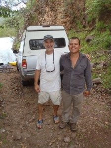
The next morning we inquired in Bacerac about drivers to do our shuttle. The lady in the store thought we were “el loco” but a local that spoke some English helped out by rounding up a driver. We apparently needed a “special” driver for the mountains. Pasqual was his name and we let him drive to the put-in at Tres Rios. And boy did he drive! He would make a great rally driver as he drove really fast, no matter what the road conditions. We gassed up at the store in Nacori Chico which sells gasoline by the liter out of a barrel. People told us about 3.5 to 4 hours to Tres Rios. Pasqual made it in 3 hours! After unloading the boats and equipment and paying half of the negotiated price (500 pesos), we let Pasqual head back to town. He probably made it in record time!
We put the boats together and launched around 6:15 p.m. on what I thought was about 10 cumecs (350 cfs) – a bit creek like. There was a strainer under the bridge just below our launch point, but it didn’t present too much of a problem. We made camp not too far down as it was getting dark by then.
DAY 2
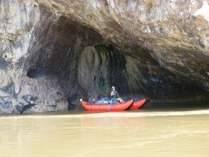
The water was down just a bit in the morning… There were plenty of farms and cows along the river, and a few mota (marijuana) plots. We found good water to filter using our trusty Platypus gravity filter at San Antonio creek and at Arroyo La Nutria. There was nothing much approaching Class II this first full day on the water; the major hazards were trees in the water and a few low hanging wires/pipes crossing the river to supply water to the fields. This section has some cool caves in the rocks above the river and we ate lunch near a cave at river level.
DAY 3
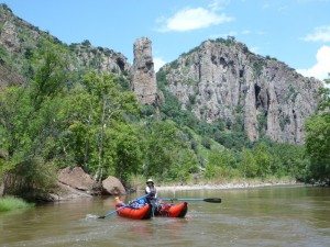
The water was down a bit again in the morning, but still probably around 8 to 10 cumecs with the water coming in from the arroyos. There was plenty of good water to filter at Arroyo Cebodilla. Lacey hiked up the arroyo a bit and found it had a bit of a slot canyon. The river walls closed in and there were beautiful rock formations in this section and numerous caves. There was a neat little waterfall grotto on RR at kilometer 56. We contemplated stopping above the Barranca Bavispe, but it was still early. Besides, the beta on the first big rapid “Muralla” was that it was class IV but might be tight for a large raft. We had our small catarafts, so it shouldn’t be a problem…
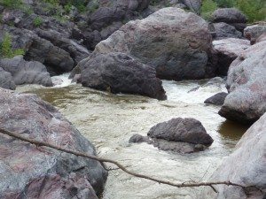
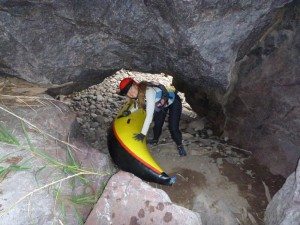
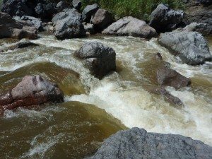
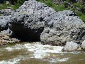
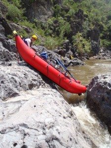
We made it to Muralla about 5:00 and it was not good to say the least. At this low flow, there was a left slot that was about 3 (yes 3) feet wide with a 5 foot drop onto a guard rock before heading down a calm passage between the cliffs and the huge boulders in the streambed. The calm passage was near vertical-walled and only about 3 to 5 feet wide (2 feet wide at the narrowest point). The right slot at the top was a bit wider and less abrupt but led into a completely unrunnable sieve where all the water went under the boulders or off towards the left passage. It was a mandatory portage for us, but how? We investigated and found a route on RR to get around this obstacle. It did, however, require us to completely break down the boats and take them piece by piece through a small cave/passage to reach the other side. At least we could leave the tubes inflated! This took about 2.5 hours and by then it was getting dark. We ran the next Class III in the dark and then pulled out on a cobble bar to look for a place to camp. Luckily, Lacey found one that would be safe enough if the water came up (likely on these monsoon-fed rivers) and we tied the boats high as well.
DAY 4
We were now fully into the Barranca Bavispe and the major rapids of the trip are on this section. Some of the Class III rapids below Muralla required lifting a tube to get through slots that were narrower than the boats. The rapid “Gato” required a scout and with the low water a bit of ingenuity to “run” safely. There were several slots at Gato, none of them wide enough for the boats. Higher water would clean this rapid up considerably. We decided to line the boats over the first drop/slot and pull them in below where we could jump on and run the rest of the rapid.
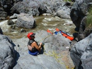
I rigged a “friction brake” on a small tree with an anchor to a boulder in case the boats got away from us in the current. The brake worked great and was largely unnecessary as I was able to hold the line and let each boat down to where Lacey could pull it in to shore. The rest of the rapid and the Class IIIs below did not present any problems. Arroyo 65 km had a nice Class III+ rapid above it and the stream in the arroyo had some cool pools for swimming.
Below was the last “hard” rapid of the trip (Angel’s Cesspool) and at this low level, it was completely blocked by large boulders. The rocks created a cavelike passage on the left that was way too small for the catarafts; it was blocked by a tree anyway! The right slots were only about 2 feet wide. This one required us to lighten up the boats by taking most of the gear around so that we could lift them up and onto the right side boulders to drop them on the other side. If the water was about 5 feet higher, you could probably just run right. We ate a well-deserved lunch below as we covered about 6 km in 5 hours… The canyon opened up below Angel’s Cesspool and the current slowed. I suggest taking out at Cobora with access from Huachenera if possible. The rest of the day we saw nothing over Class II but encountered several strainers.
DAY 5
Our last day on the Rio Bavispe. We had 22 km to do and had told the shuttle driver to meet us at noon, so we had to push. I didn’t help things when I went down a left side channel at a large island and encountered yet another strainer. This one required us to carry the boats around… We made it to the park/take-out around 12:30 and our truck was not there. It looks like it had been there from the lone set of tire tracks. Oh well, we broke down the boats, dried things off, ate lunch, and got things ready to load when the truck arrives. It doesn’t, so I walked to town (about 4 km) to see if I can find the truck and/or driver. I looked up our helpful English speaker, Senor Davila) and he informed me that Pasqual had to go to Agua Prieta (emergency). But, the truck is at a friends house so off we went to find it. I felt a bit like I was just being driven around town for fun, but we did indeed find the truck, safe and sound, at Polo’s (a friend of Pasquale) house. He gave me the key and I raced back to the park to check in with Lacey. She had everything ready to load, so we did and then headed into town for some beers to go with our dinner at the park. We camped at the park under a big orange full moon.
CONCLUSION
The water was too LOW! approximately 30 cumecs at Bacerac is not enough. Perhaps 60 to 100 cumecs would be sufficient. Any more than this and the portage route at Muralla may not exist, necessitating a difficult and dangerous lining on the left. Would I do the Bavispe again? Probably not. While parts of the canyon are extremely beautiful, the work involved with the portages isn’t warranted given the quality of the remaining whitewater. At least at low flows, the river is mostly Class II except for the Barranca with several Class IIIs and a couple of portages that are not particularly easy. I just think there are other options in northern Sonora that offer better whitewater, comparable scenery, and are less likely to require a portage, perhaps the Rio Tutuaca. We will be exploring some of them in the future!

